MEASURE FF - VOTER APPROVED GENERAL PLAN'S DESCRIPTION OF OUR URBAN GROWTH BOUNDARY
URBAN GROWTH BOUNDARY
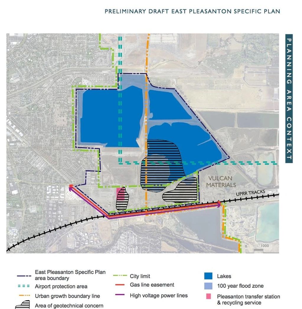
The General Plan Map designates an Urban Growth Boundary (UGB) line around the edge of land planned for urban development at General Plan buildout. The line distinguishes areas generally suitable for urban development and the provision of urban public facilities and services from areas generally suitable for the long-term portection of natural resources, large lot agriculture and grazing, parks and recreation, public health and safety, subregionally significant wildlands, buffers between communities, and scenic ridgeline views. The UBG is intended to be permanent and to define the line beyond which urban development will not occur.
Lower densities should be encouraged along the inside edge of the UGB to provide a transition/buffer for preventing potential conflicts with uses immediately beyond the boundary such as agriculture and wildlands.
Since the UGB is considered to be permanent, future adjustments are discouraged. However, minor adjustments may be granted, which meet all of the following criteria: (1) are otherwise consistent with the goals and policies of the General Plan: (2) would not have a significant adverse impact on agriculture, wildland areas, or scenic ridgelilne views; (3) are contiguous with existing urban development or with property for which all discretionary approvals for urban development have been granted; (4) would not induce further adjustments to the boundary; and (5) demonstrate that the full range of urban public facilities and services will be adequately provided in an efficient and timely manner.
UGB location adjacent to areas designated for Sand and Gravel Harvesting in East Pleasanton should be re-evaluated at such time as comprehensive land use designation changes are considered for the reclaimed quarry lands. The existing Little Valley Road neighborhood in South Pleasanton is designated as Rural Density Residential, and located beyond the UGB. However, since this neighborhood is an existing partially developed area, five-acre minimum parcel sizes may be permitted without the provision of standard urban water and sewer service, subject to public health and safety considerations.

Pleasanton's City Limit Line, Urban Growth Boundary and Sphere of Influence

Map of City Limit and Urban Growth Boundary relating to East Pleasanton Specific Plan